Lab 9: Remote Sensing of Water Resources
Due Date: April 13, 2004
Objectives
·
To understand
and identify considerations when remote sensing water resources.
·
Become familiar
with several practical remote sensing water resource applications.
Remote sensing and GIS technologies
offer a wide range of applications suitable for water resource investigation.
Among these, the capability of discriminating among different land cover types
using aircraft and satellite imagery is one of the most important. Cover
classes may be identified for their significance to processes such as runoff
yield, interception, and evapotranspiration. This type of information is useful
for modeling basin-wide components of the water budget. Basin and channel
features influence runoff and sedimentation in a watershed. GIS spatial
analytic techniques can quantify such characteristics as slope, aspect, channel
length, and drainage density. Low-altitude aerial photographs can be used to
monitor changes in channel geometry over time.
Remote sensing and GIS are also
useful for groundwater investigations. On a regional level, satellite imagery
can be examined to define watershed boundaries, fracture zones, drainage
patterns, and other features of hydrogeologic significance. Stereo viewing of
large-scale aerial photography for relief and vegetation patterns, in
conjunction with ground-referencing techniques, can provide valuable insights
for localized studies. In some cases, airborne imagery can be used to locate
seeps and springs.
Evaluating Impacts
of Hurricane Floyd
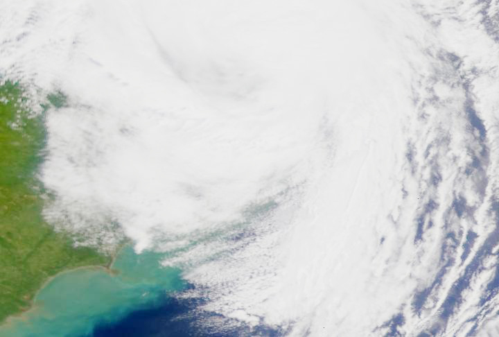
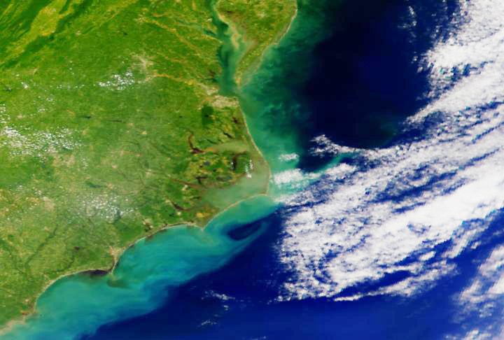
Hurricane Floyd
churned the coastal waterways of North Carolina like a spoon in a mixing bowl.
Following Floyd, record breaking rains continued to soak the area, washing
mountains of sediment and waste into the water system. Rivers and tributaries
along the Atlantic became choked, and major ecological changes happened as
evidenced in the SeaWifs images below. Levels of dissolved oxygen in the water
dropped dramatically as organic matter decomposed, and aquatic life was
threatened in dozens of estuaries and peripheral habitats. For people living in
the region, the flood that began with Floyd was just the beginning. As
illustrated in the following images, the changes to the area since this rainy
season began affected hundreds of thousands of people.

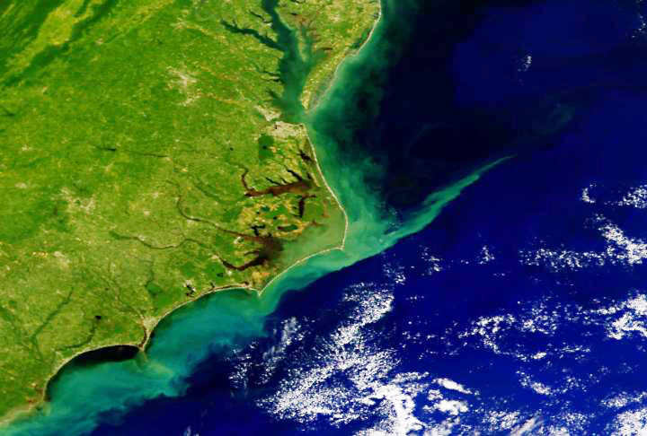
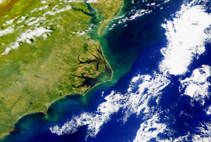
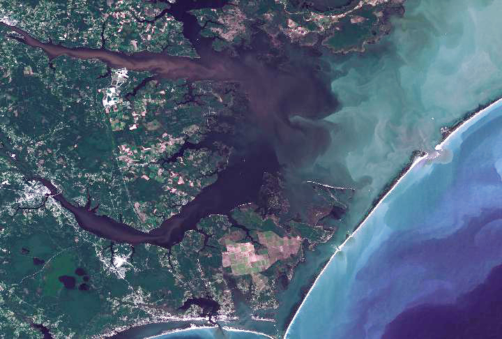
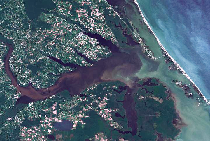
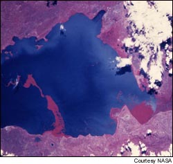
From space, Landsat 7 captured the
massive flow of sedimentation and waste runoff in the area most affected by
flooding. Notice the dark coloration in the engorged waterways, indicating
heavy concentrations of organic material that was washed into the water system.
|
|
|
|

Courtesy of NASA's
Scientific Visualization Studio.
ASSIGNMENT
1. After a careful
analysis of the above imagery, describe how remote sensing technology can be
used as a tool to assess Hurricane Floyd's effect on algae blooms and
phytoplankton, important links in the regional marine food chain, and how it
could help to understand how the hurricane's aftermath might affect the fragile
environment in the months after the event.
2. As a remote sensing specialist,
choose one of the five scenarios listed below and write a discussion on the
appropriate sensor systems to be used, suitable bands, identification of
necessary biophysical variables, special considerations in remote sensing of
water resources, and any other factors you would investigate (such as ancillary
data integration). Be sure to include logic and examples from the text.
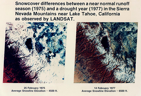
a. Estimating Snow Pack in California
You are
recruited by the State of California to develop a new model using remote
sensing technology that will predict future water supplies for the state.
Satellite observations of surfaces blanketed by snow are often used to measure
the areal extent of the masses likely to melt and track seasonal variation in
snow cover from year to year. The State of California wants you to set up a
cooperative snow survey project that involves estimating water supply
conditions throughout California in the form of snowpack conditions and
watershed runoff forecasts.
b. Preserving Water Quality in
Florida Bay
You have been hired by the Florida Department of Environmental
Protection as a remote sensing specialist to help restore water quality and
improve marine habitat in the Florida Bay, an estuary ecosystem that comprises
nearly 1000 square miles between the Florida Everglades and the Florida Keys.
This estuary provides nursery habitat for immense numbers of fish species and
other marine life that are fundamental to Florida's Tourism industry as well as
the many ecosystems that extend beyond Florida Bay. In recent years adverse
changes in Florida Bay have been observed. These changes include seagrass and
sponge dieoffs, fish and crustacean population decreases, and a decline in
water quality.
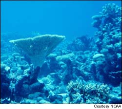
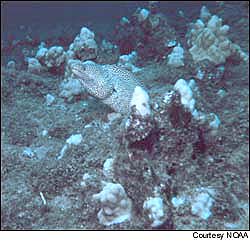
c. Long-Term Monitoring of
Caribbean Coral Reefs
You are to
produce the first comprehensive set of digital maps of coral reefs for the
Caribbean Sea. Less than 10 percent of all coral reefs have been adequately
mapped and characterized to determine their current condition. It is important
to develop a coral reef map so these areas can be protected. The maps will
create an accurate baseline for long-term monitoring, illustrate trends in reef
health over time, characterize habitats and enhance scientific understanding of
large-scale oceanographic and ecological processes affecting reefs.
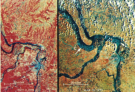
d. Flood Management on the
Mississippi
FEMA is
hiring you to investigate new models and methods to reduce the impacts and
dangers of flooding on the Mississippi River using remote sensing technology.
Spring flooding is frequent in parts of the Mississippi River basin where a
hundred-year flood, (i.e., largest expected statistically in a 100-yr span) can
occur on a less than twenty year cycle. Excessive rain can saturates the soil,
break levees, inundate tens of thousands of acres, and cause up to $15 billion
in damage as it did in the 1993 flood.
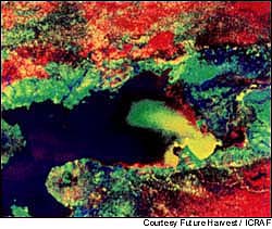
e. Fighting Hyacinth on Lake
Victoria
A recent
unexpected discovery has uncovered a source of nutrients that has allowed a
water weed to grow out of control in Africa's Lake Victoria and is putting a
stranglehold on the lake's environment. You have been commissioned by the
Kenya-based International Center for Research to use satellite technology to
detect plumes of nitrogen- and phosphorous-rich sediments that are feeding the
water hyacinth, a floating weed that starves fish and plankton of oxygen and
sunlight. The hyacinth also blocks waterway traffic, causing water in the lake
to stagnate. This makes the shoreline a breeding ground for mosquitoes that
spread malaria and snails that are a host of bilharzia, a human parasite that
attacks the liver, lungs and eyes. Hyacinth grows around the edge of the lake
and creates a snake-like web of roots in the water. It impedes fishing boats
from going out and is choking the commerce that occurs around the lake.
3. The integration
of remote sensing and GIS with water quality models is becoming increasingly
important as urban areas continue to expand. Models can be developed which
predict surface-sampled water quality parameters such as turbidity,
chlorophyll-a concentration, and surface temperature from digital image data.
Thermal band imagery is extremely useful in creating the river and lake
temperature maps that are necessary for some environmental and biological
related projects. Images acquired from both airborne and spaceborne sensors are
used for this purpose. These models can then be applied to water covered areas
in the image, enabling generation of surface water quality maps. What
information might be derived from such models that a water resource manager
would benefit from?