
Figure 34. View of the Blackland Prairie in southern Dallas County, near Lancaster. The deep clayey soils here are used for cropland - natural vegetation would be prairie grasslands.
Site 4. Blackland Prairie.
Deep calcareous clayey soils have developed in the Blackland Prairie region. The limestones, marls and shales underlying the region erode fairly evenly, producing flat to gently sloping grasslands.
Figure 34. View of the Blackland Prairie in southern Dallas County, near
Lancaster. The deep clayey soils here are used for cropland - natural vegetation
would be prairie grasslands.
The bedrocks in this region produce soils rich in expansive clays. The clay gives the bedrock distinctive layering and causes it to breakdown easily.

Figure 35. Marl bedrock (clayey limestone) in southeast Dallas County, near
Hutchins. The high clay content produces clear layering within the rock.

Figure 36. Swelling and shrinking of the clay in this bedrock causes it to split
into thin sheets and break apart easily.
The deep clayey soils support dense grasslands which add abundant organic matter to the soil, giving it a black color.

Figure 37. Deep clay and organic-rich soil in the Blackland Prairie region.
Typical native vegetation in the region includes Big Bluestem, Little Bluestem, Sideoats Grama, Indian Grass and Switch Grass (grasses), scattered Mesquite (shrub) and Elm and Hackberry trees in creek bottoms.

Figure 38. Big Bluestem.

Figure 39. Little Bluestem.

Figure 40. Sideoats Grama.

Figure 41. Indian Grass.
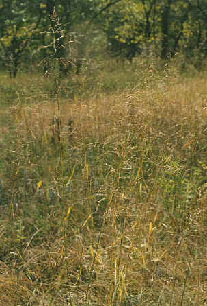
Figure 42. Switch Grass.

Figure 43. Mesquite.

Figure 44. American Elm.
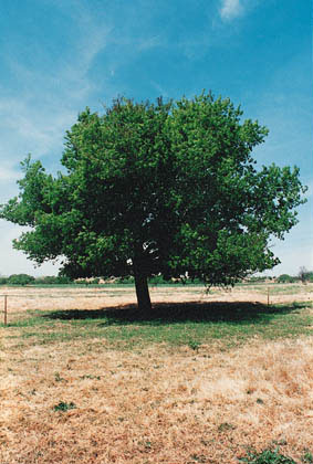
Figure 45. Netleaf Hackberry.