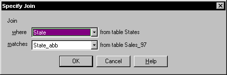
Specifying a relational join - the tables are joined where text in a field (state) from one table matches text in a field (state_abb) from another table.
THEMATIC MAPPING II
Creating A Thematic Map With Data From A Different Table
You can create a thematic map with data from a different table by joining the tables. If the 2 tables have a common field (e.g. name of a state or county… etc) a relational join is used to link the tables during creation of the thematic map. This is similar to joining tables using Query|SQL (see "working with data tables"). The difference here is that the relational join is done "on the fly" during the creation of the map.
Specifying a relational join - the tables are joined where text in a
field (state) from one table matches text in a field (state_abb) from another
table.
The alternative method is the geographical join – this is used if the tables do not have common fields, but do have map objects that overlap.
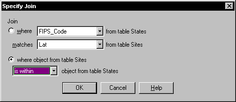
Specifying a geographic join - the tables are joined where the objects
from the sites table (point locations) are within the object from the states
table (state regions).
Note that the values calculated by
this type of join are temporary – if you close the table they will be lost, but
if you save the workspace, the map and the data will be recreated when you
reopen it.
The”data” that will be used to
create the thematic map can be generated by built-in expressions, as shown
below:
