Exam 1
PHYSICAL GEOLOGY EXAM 1 REVIEW
Atoms: consist of PROTONS, NEUTRONS and ELECTRONS. The protons and neutrons are found in the NUCLEUS and the electrons orbit the nucleus in ELECTRON SHELLS or ENERGY LEVELS. All protons have a positive electrical charge, while all electrons have a negative electrical charge; since atoms have an equal number of protons and electrons, and neutrons have no charge, all atoms are electrically neutral (the electrical charges cancel).
Atoms can be classified by the number of protons, which is known as the ATOMIC NUMBER, and also determines the element e.g.
6 protons......atomic number = 6 -> element = CARBON
8 protons......atomic number = 8 -> element = OXYGEN
Most atoms also contain a number of neutrons in the nucleus and can therefore also be classified by the sum of protons and neutrons, which is known as the ATOMIC MASS (protons and neutrons both have an atomic mass of "1", whereas electrons are so small they can be ignored).
Since the number of neutrons in an atom can vary, some atoms of the same element can have different mass numbers. These variations are known as ISOTOPES e.g.
6 protons + 6 neutrons...atomic mass = 12 -> CARBON 12
6 protons + 8 neutrons...atomic mass = 14 -> CARBON 14
8 protons + 8 neutrons...atomic mass = 16 -> OXYGEN 16
8 protons + 10 neutrons..atomic mass = 18 -> OXYGEN 18
ENERGY LEVELS: Atoms have no more than 2 electrons in their innermost shell. Atoms are at their most stable when they have exactly 8 electrons in their outermost shell; atoms will therefore tend to lose or gain electrons in order to achieve exactly eight electrons in their outermost shell (octet rule).
IONIC BONDING: the "lending and borrowing" of electrons to achieve 8 electrons in the outermost shell; these atoms now become electrically charged or IONS. Unlike charges attract, forming a strong IONIC BOND.
COVALENT BONDING: "Sharing electrons" e.g. 2 chlorine atoms with energy levels containing 2-8-7 electrons can each share 1 electron with the other, giving both in effect, energy levels of 2-8-8 and forming a single molecule of chlorine gas. Covalent bonds tend to be the strongest type of atomic bonding.
METALLIC BONDING: Metals have a special kind of bonding where electrons are shared with all other atoms, rather than just between adjacent pairs. This arrangement gives metals their properties of electrical and thermal conductivity, softness and malleability.
VAN DER WAALS BONDS: Result from weak electrical attractions caused by minor charge imbalances between certain ions. They are much weaker than the strong ionic and covalent bonds.
ATOMIC STRUCTURE: An orderly, consistent 3-dimensional arrangement (a CRYSTAL STRUCTURE).
MINERALS: A combination of atoms of various elements. Main elements in crust = Oxygen, Silicon, Aluminum, Iron, Calcium, Sodium, Potassium, Magnesium.
LUSTER: The appearance of light reflected from the mineral.
COLOR: Usually not a diagnostic property, but felsic (nonferromagnesium) minerals are normally LIGHT COLORED, whereas mafic (ferromagnesium) minerals are normally DARK COLORED.
STREAK: Color of a mineral in powdered form - diagnostic.
HARDNESS: MOHS hardness scale from 1 to 10.
CLEAVAGE: Splitting of minerals along planes of weakness (due to weak atomic bonds) - diagnostic.
FRACTURE: Refers to the way a mineral breaks - NOT ALONG A CLEAVAGE PLANE.
SPECIFIC GRAVITY: Ratio of weight of mineral to weight of equal volume of water. e.g quartz about 2.6; gold about 20.0.
ACID TEST: CALCITE (calcium carbonate) reacts with weak hydrochloric acid, resulting "fizz" identifies this mineral.
Nonferromagnesium silicates: (aluminosilicates or felsic minerals) - lack iron and magnesium -> usually light-coloured, relatively low S.G. of around 2.7 (due to lack of heavy iron).
Egs. QUARTZ (SiO2): Strongly bonded in all directions; no cleavage planes; Hardness of 7; Conchoidal fracture.
FELDSPARS (K, Na, Ca-rich aluminosilicate): most common minerals; 2 cleavage planes at 90o; Hardness of 6.
MUSCOVITE MICA (Hydrous K, aluminosilicate) 1 excellent cleavage plane (cleaves into thin sheets); Hardness of 2 - 3.
Ferromagnesium silicates: (mafic minerals) - silicate + iron and magnesium -> usually dark-colored, denser, higher S.G.
Egs: PYROXENES (Silicates of Al, Ca, Mg and Fe); 2 cleavage planes at about 90o; Hardness of 5 - 6.
OLIVINE (Silicate of Mg and Fe); no cleavage; Hardness of 6.5 - 7.0.; Conchoidal fracture
BIOTITE MICA (Hydrous Al, Mg, Fe, K, silicate); Similar to muscovite mica, but contains iron and magnesium -> dark color.
NON-SILICATE MINERALS: Carbonates - element(s) + carbon-oxygen eg. Calcite (calcium carbonate).
Halides - precipitate from bodies of water due to intense evaporation egs. Halite (Salt).
Oxides - element(s) + oxygen. E.g. Hematite (Iron Oxide).
Sulfides - element(s) + sulfur. E.g.
Sulfates - contain sulfer and oxygen e.g. Gypsum (hydrous calcium sulfate).
Native Elements - single element. E.g. gold, silver.
IGNEOUS ROCKS: formed by cooling of molten rock (MAGMA or LAVA). Classification based on TEXTURE and MINERAL CONTENT.
TEXTURE: a. EXTRUSIVE (volcanic) IGNEOUS ROCKS - form on surface rapid cooling -> small crystal size (APHANITIC TEXTURE). Extremely rapid cooling -> volcanic glass - obsidian.
PORPHYRITIC TEXTURE - fine-grained GROUNDMASS surrounding larger PHENOCRYSTS (mixture of coarse and fine crystals).
VESICULAR STRUCTURE. holes formed by gas bubbles in lava. Extreme amount of gas bubbles -> pumice.
b. INTRUSIVE (plutonic) IGNEOUS ROCKS - form beneath surface -> slow cooling -> large crystals (PHANERITIC TEXTURE)
MINERAL CONTENT: depends on magma composition and BOWEN'S REACTION SERIES.
Discontinuous Reaction Series: Olivine-pyroxene-amphibole-biotite mica (progressively less mafic minerals form at progressively lower temperatures)
Continuous Reaction Series: progressive change from calcium-rich to sodium-rich feldspar with decreasing temperature.
CLASSIFICATION OF IGNEOUS ROCKS: GRANITIC ROCKS - felsic: intrusive rock = GRANITE, extrusive equivalent=RHYOLITE.
ANDESITIC ROCKS - intermediate: intrusive = DIORITE, extrusive form = ANDESITE. BASALTIC ROCKS - mafic: intrusive = GABBRO, extrusive = BASALT. ULTRAMAFICS: intrusive = PERIDOTITE, extrusive = KOMATITE (very rare).
OCCURRENCE OF IGNEOUS ROCKS: Batholiths, laccoliths, lava flows, sills, dykes, volcanic necks.
TYPES OF VOLCANO: 1. SHIELD VOLCANOES: 2. CINDER CONES:
3. COMPOSITE CONES (or STRATOVOLCANOES): 4. CALDERAS:
MECHANICAL WEATHERING: a). FROST WEDGING: b). UNLOADING:
c). THERMAL WEATHERING: d). ORGANIC ACTIVITY:
CHEMICAL WEATHERING: a). SOLUTION: b). HYDROLYSIS: c. OXIDATION:
SOILS The major byproduct of weathering is SOIL = weathered rock (mainly clay and sand) + decayed organic matter + air + water. The decay of the organic matter and the decay of rock releases nutrients such as potassium, calcium and magnesium which are dissolved into soil water and can be used by plants.
SEDIMENTARY ROCKS: Weathering produces SEDIMENT = particles and dissolved material. When this sediment becomes LITHIFIED, a layer of solid SEDIMENTARY ROCK is formed. About 75% of all rocks exposed on the surface of the continents are sedimentary rocks.
DETRITAL SEDIMENTARY ROCKS (formed from particles): COMPACTION and CEMENTATION -> lithification. The cement forms the SECONDARY MINERALS of a sedimentary rock (original fragments=inherited minerals). Detrital sedimentary rocks are distinguished mainly by TEXTURE (size): CONGLOMERATE (rounded), BRECCIA (angular),
SANDSTONE, SHALE and MUDSTONE.
CHEMICAL SEDIMENTARY ROCKS: Formed by the precipitation of minerals dissolved in water. 1. CARBONATES - many marine organisms have the ability to extract minerals dissolved in water to form shells (oysters, coral). The most common mineral used is CALCITE (calcium carbonate). When the organism dies, the shell fragments accumulate on the sea floor and are lithified into the rock LIMESTONE. The replacement of some of the calcium by magnesium forms magnesium-rich limestone known as DOLOSTONE.
2. SILICEOUS ROCKS - some organisms extract dissolved SILICA, forming rocks such as flint and chert, which are basically forms of quartz (SiO2). 3. CARBONACEOUS ROCKS - lithified organic matter eg. COAL. 4. HALIDES - evaporation of saline waters eg. Rock salt (sodium chloride). 5. SULFATES - also formed by evaporation of water e.g. Rock gypsum (hydrous calcium sulfate).
METAMORPHIC ROCKS: Metamorphism means "change form". Result of:
1. HEAT - Often the heat causes the rock to become "PLASTIC", meaning that the minerals can move around and slowly slide past each other, (WITHOUT MELTING TAKING PLACE).
2. PRESSURE - usually directional, such as compression (like squeezing the rock in a giant vise).
3. CHEMICAL ACTION - water containing ions can help speed up chemical reactions, facilitating the formation of new minerals.
The heat and pressure "metamorphoses" rock usually by causing: (i) the formation of new minerals within the rock by "squeezing*" atoms into new structures, and, often, (ii) A FOLIATED TEXTURE - the parallel alignment of platey mineral grains resulting from their adjustment to pressure, giving the rock a layered appearance. (*note - a common property of metamorphic rocks is that they are often denser than the original rock, because they form under pressure).
METAMORPHIC SETTINGS: usually deep within the Earth - often between 3 and 40 km depth. Once formed, can be exposed by uplift and erosion. There are three types of metamorphism:
a. CONTACT METAMORPHISM: rocks in contact with igneous intrusions are "baked" by the high temperatures -> metamorphic aureole.
b. REGIONAL METAMORPHISM: large scale heat and pressure due to earth movements. The compression of large segments of the Earth's crust occurs due to TECTONIC ACTIVITY (covered later in course).
c. DYNAMIC METAMORPHISM: occurs along fault zones, where rocks are shattered, usually producing fault BRECCIAS.
METAMORPHIC TEXTURES: based on foliation: a. SLATE - clay minerals in SHALE are transformed into minute flakes of mica, which align themselves perpendicular to the direction of pressure, forming very fine, flat, parallel planes of foliation. This results in "rock cleavage" (not to be confused with mineral cleavage), which means the rock splits very easily along the foliation planes. Slate forms under LOW-GRADE metamorphism (i.e. relatively low temperature and pressure). b. PHYLLITE - LOW-INTERMEDIATE GRADE metamorphism of shale causes growth of larger, but still invisible, mica or chlorite crystals. c. SCHIST - INTERMEDIATE GRADE metamorphism of shale causes the growth of larger mica flakes, visible to the naked eye. The alignment of platey minerals forms distinct, visible layers - often wavy.
c. GNEISS - during HIGH GRADE metamorphism, the movement of ions is so great that minerals are segregated into dark and light bands, consisting of felsic and mafic minerals. This most often occurs in coarse grained, high-silica rocks eg. intrusive igneous rocks, such as granite. NONFOLIATED METAMORPHIC ROCKS: Metamorphosed limestone: recrystallization of calcite minerals forms a coarse, crystalline rock -> MARBLE. Metamorphosed quartz sandstone: the cement is removed and the quartz crystals fuse together, forming a mass of crystalline quartz -> QUARTZITE
Example Questions
1. A mineral formed entirely from silicon and oxygen is:
a. halite b. quartz c. muscovite mica d. plagioclase feldspar e. silox
2. Dolostone is:
a. iron-rich limestone b. iron-rich granite c. magnesium-rich granite d. magnesium-rich limestone e. iron-rich shale
3. Which of the following sequences contains an igneous, sedimentary and igneous rock, in that order:
a. sandstone, granite, basalt b. granite, shale, sandstone
c. basalt, andesite, shale d. limestone, granite, shale
e. basalt, limestone, granite
4. Hydrolysis is best described as:
a. chemical weathering of minerals by acidic water b. solution of a mineral c. the loss of electrons to oxygen d. the absorption of water into a mineral's atomic structure e. a form of rust
5. Slate is metamorphosed:
a. sandstone b. shale c. basalt d. limestone e. quartz
EXAM 2 REVIEW
GEOLOGIC TIME
A major part of the study of geology is determining the AGE of rocks. There are two approaches to the DATING OF ROCKS:
1. Before the advent of modern technology, the approach of RELATIVE DATING was taken. This means that rocks could be placed in order from oldest to youngest, but the actual age of a rock in years was not known.
2. More recently, modern techniques have been developed that make use of RADIOACTIVE ELEMENTS to carry out ABSOLUTE DATING i.e. the actual age of a rock in years can be measured.
RELATIVE DATING
1. Principle of Superposition (NICOLAUS STENO (1669):
In any sequence of undisturbed strata, the oldest layer is at the bottom and successively higher layers are successively younger. Connected to this is the idea of conformable and unconformable sequences. A conformable sequence is one in which there has been continuous deposition of sediment such that the resulting rocks GRADE one into another via gradational contacts. An unconformable sequence is one in which deposition has been interrupted by a period of erosion, causing removal of some layers and resulting in an erosional contact and an unconformity (see Fig. 18.3 and 18.7). There are angular unconformities, disconformities and nonconformities.
2. Principle of Original Horizontality (NICOLAUS STENO (1669):
Most sedimentary rocks formed originally in close-to-horizontal layers (although many have since been moved from their original position).
3. Principle of Original Lateral Continuity (NICOLAUS STENO (1669):
Originally sedimentary strata extended in all directions until they either; thinned out, ended abruptly at some kind of barrier or graded into a different kind of sedimentary rock. This principle is important for correlating sedimentary rocks from place to place i.e. across a valley (see Fig. 18.10). Stratigraphic correlation is the practice of "matching up" equivalent bodies of rock from different locations. The equivalence may be in terms of lithology, age or fossil content.
4. Principle of Uniformitarianism (JAMES HUTTON (1726 - 1797): "The present is the key to the past" i.e. geologic processes operating today also operated in the past. e.g. river deposits forming today have a similar composition and character as their ancient counterparts; glacial erosional and depositional features are basically the same today as in the past...etc.
5. Principle of Biological (or fossil) Succession (WILLIAM "STRATA" SMITH (1769 - 1839):
Different kinds of plants and animals succeed one another in time because life has evolved continuously; therefore only rocks formed during the same age can contain the same (or similar) assemblage fossils (see Fig. 18.13). Since these fossil assemblages are unique for particular periods of the past, they can be used to:
a. correlate contemporaneous rocks from around the world, and to
b. order rock layers into a chronological sequence.
6. Principle of Cross-Cutting Relationships CHARLES LYELL (1830):
Any geologic feature which cuts across or penetrates another body of rock must be younger than the rock mass penetrated (see Fig. 18.5).
7. Principle of Inclusions CHARLES LYELL (1830):
Any rock that contains fragments of an adjacent rock must be younger than the adjacent rock (see Fig. 18.6).
THE GEOLOGIC TIME SCALE
The standard geologic time scale was not developed in an organized and systematic manner. Instead, the scale took shape over centuries as a number of geologists discovered and named the various intervals. Often these divisions were named after the local area or the type of rocks present. Absolute dating was not available and so each interval was based mainly on fossils and reflected a major change in life forms. The relative order of the divisions was based on superposition and correlation.
Divisions:
Eons - Precambrian + Phanerozoic (evident life)
Eras - Paleozoic (ancient life) (542-251 mybp); Mesozoic (middle life) (251-66 mybp); Cenozoic (recent life) (66 mybp-present day).
Periods - each era is divided into a number of periods, based on life form changes.
It is interesting to note that although the earliest-known life is over 3.2 billion years old, there is very little fossil evidence for it. It is not until about 540 million years ago that fossils became abundant, probably due to the development of hard body parts (shells, skeletons).
ABSOLUTE DATING
Radiometric Dating Methods
Based on radioactive decay i.e. certain isotopes (Parent) spontaneously emit atomic particles (protons and neutrons) and in so doing change to a different element (Daughter).
When dealing with a large number of atoms it is possible to predict how long it will take FOR HALF OF THEM TO DECAY - this is the HALF LIFE (see Fig. 18.16).
These radiometric dating methods are best suited to IGNEOUS rocks, since the radioactive elements and their daughter elements are "locked" in the mineral crystals when the rock solidifies from magma. These methods are not well-suited to metamorphic rocks since heating of the original rock may release the daughter elements, "resetting" the radiometric clock to the time of the last episode of heating.
Using these methods for sedimentary rocks will give the age of the rock and mineral particles that make up the rock, not the time of deposition of sediment. Instead, sedimentary rocks are often dated by enclosing or intruding igneous rocks.
Radiocarbon Dating
Radiocarbon (14C) has a half-life of 5730 years and is used for dating organic material (eg. wood, bone..) up to only about 70,000 years old - useful for archaeology and very recent geologic events, such as the last ice age (ended 10,000 years ago).
14C is naturally produced in the atmosphere by cosmic rays -> RATIO OF 14C/REGULAR CARBON (12C) IS CONSTANT IN ALL LIVING ORGANISMS. Once the organism dies the 14C/regular carbon ratio decreases. If 14C/regular carbon ratio = 50% of modern ratio, material is 1 half-life, or 5730 years, old; if ratio = 25%, material is 2 half-lives old (11460 years) and so on.
MASS WASTING:
DENUDATION - the overall wearing away and lowering of continental surfaces, achieved by: 1. WEATHERING (rock disintegration without significant movement) 2. MASS WASTING (the DOWNSLOPE movement of sediment by gravity) 3. EROSION (the removal of sediment by rivers, glaciers, wind..etc.).
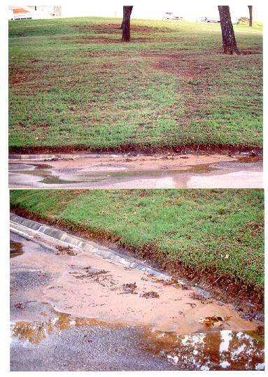
Denudation In
Factors contributing to mass wasting: 1. REDUCED COHESION: e.g. water saturation 2. LOADING: increasing the weight on a slope will increase the force pushing the slope material downslope; e.g. water saturation. 3. OVERSTEEPENING: the steeper the slope the greater the pull of gravity acting downslope. 4. UNDERCUTTING: refers to the removal of support from the base of a slope e.g. river erosion, wave attack. Types of Mass Wasting: Based on: 1. MATERIAL TYPE: Rock, Debris (coarse and fine sediment), Earth or Mud (fine sediment). 2. TYPE OF MOTION: You should know the difference between Falls, Slides, Slumps, Flows (debris flows, earthflows and mudflows) and Creep. You should know what alluvial fans are and how they form.
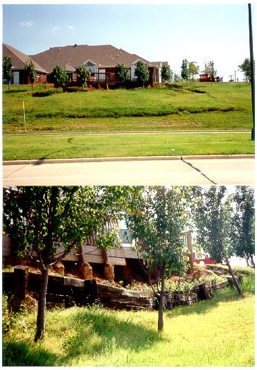
A small slump in
GROUNDWATER: You should know the following terms: AERATION ZONE, GROUNDWATER, WATER TABLE, CAPILLARY FRINGE, POROSITY (Uncompacted clay...50% Sand and gravel....20% Solid granite....1-10%), BASEFLOW, GROUNDWATER RECHARGE, GROUNDWATER DISCHARGE, PERMEABILITY, AQUICLUDE/AQUITARD, AQUIFER, PERCHED WATER TABLE, SPRING, ARTESIAN SYSTEM, CONE OF DEPRESSION.
RIVERS:
Stream Erosion: Erosion is carried out by TURBULENT FLOW, which exerts DRAG and LIFT forces on rock particles. Most natural flow is turbulent, rather than laminar. The amount of turbulence (and thus erosive power) depends on 2 factors - the ROUGHNESS of the channel and the FLOW VELOCITY. DISCHARGE - the amount of water moving through the channel - can be calculated by:
DISCHARGE (Q) = CHANNEL CROSS-SECTIONAL AREA (A) X VELOCITY (V)
and is usually expressed in cubic meters per second. Because higher discharge increases velocity and higher velocity increases erosion, there is often a strong correlation between these factors. Stream Erosion = transportation of sediment. Most of the sediment is produced by WEATHERING and moved into the channel by MASS WASTING. The river can move sediment in 3 ways:
1. SOLUTION (
2. SUSPENSION (" = 500 million tons/year)
3. BED LOAD (" = 50 million tons/year)
Suspension is usually the most important component. The amount of sediment carried (known as the CAPACITY) and the largest size of particle carried (known as the COMPETENCE) increases with increasing DISCHARGE and VELOCITY. River and stream deposits are called alluvial deposits; eg. a) Channel deposits - BARS occur on the inside of river bends (point bars) and in the channel itself (mid-channel bars - often formed in streams having large sediment loads and greatly fluctuating discharges, where they form BRAIDED STREAMS. Meltwater streams draining large glaciers are often braided). b) Floodplains - formed by flood deposits in area adjacent to channel. Since coarsest sediment is deposited first, this often forms banks immediately adjacent to the channel - these are NATURAL LEVEES. c) Alluvial Fans - mountain streams often carry large sediment loads (including debris flows & mud flows), deposition of sediment on plains forms an ALLUVIAL FAN. d) Deltas - When a stream enters a standing body of water it forms a delta - the finer particles are carried further out, forming BOTTOMSET DEPOSITS, the coarser sediment cascades down the front of the delta, forming FORESET DEPOSITS and later as the delta emerges from the sea, floodplain-like deposits form on top - TOPSET DEPOSITS.
Drainage Basins: or "river valleys"; delimited by a DRAINAGE DIVIDE. The drainage pattern can be influenced by the underlying geology (eg. radial drainage pattern on a dome; rectangular in jointed granite; trellis between resistant ridges; dendritic on uniform geology). You should also understand the concept of superposed drainage and "water gaps". Upper reaches of streams are usually characterized by low discharge, coarse sediment, steep gradient, vertical erosion, steep V-shaped valley, narrow channel, no floodplain, common waterfalls and rapids. Middle reaches = higher discharge, finer sediment due to ABRASION, gentler gradient, more LATERAL EROSION, wider valley, beginning of floodplain. Lower reaches = higher discharge, finest sediment, LATERAL EROSION, wide floodplain - floodplains characterized by point bars, cut banks, meander scars, meander cut-offs, oxbow lakes, levees, yahzoo streams, backswamps, river bluffs.
The Graded Profile And Base Level: Since streams maintain a steep slope in the upper reaches and a gentler slope in the lower reaches, a smooth, concave profile naturally develops. This is known as the GRADED PROFILE. The bottom of the profile is aligned to the stream's BASE LEVEL (the level to which the stream erodes down to, but no lower e.g resistant rock outcrop, a lake, larger stream or sea level). You should also understand how changes in base level are responsible for the formation of CANYONS, ENTRENCHED MEANDERS and TERRACES.
COASTAL PROCESSES AND LANDFORMS
Introduction
At coasts there is a constant source of energy capable of shaping the Earth's surface - wave energy. The movement of waves can:
a. ERODE rock
b. TRANSPORT rock fragments from the eroded rock and supplied to the coast by rivers
c. DEPOSIT these fragments in low energy coastal environments.
Because of constant wave action, many coasts are DYNAMIC; even apparently STATIC features such as beaches that seem to remain from year to year, are often in a state of DYNAMIC EQUILIBRIUM - with old sand continuously being removed and new sand being brought in.
Waves: waves are wind-generated oscillatory waves
This means that the waveform moves through the water, whereas the actual water particles undergo an oscillation or orbit, which decreases with depth, becoming negligible at half a wavelength depth. Wave energy depends on the height of the wave, which in turn depends primarily on the distance over which the wind is blowing - THE FETCH.
When the wave approaches the coast the water decreases to the point that bottom friction interferes with the wave, slowing it down so that the wavelength becomes smaller, while the wave height becomes larger. This steepens the wave until eventually it "breaks", sending a mass of water forward. This is how the energy of the waveform is transferred to the energy of moving water.
The effect of the energy depends on the slope of the coast. Where the coast is steep - cliffs - all the energy is concentrated in a narrow zone, causing a wave-cut notch at the base of the cliff, which periodically causes collapse and maintains the steepness of the cliff. Due to the high energy, beaches are rare, except where bays occur and the sediment is "trapped" - even here beaches are usually narrow on steep coastlines. This concentration of wave energy tends to result in mainly EROSIONAL LANDFORMS on steep coastlines. Where the slope is gentle, the wave energy is dissipated over a greater distance, which allows sediment to accumulate, forming a wide beach and other types of DEPOSITIONAL LANDFORMS.
The result of continuous wave erosion at the base of cliffed coastlines is the formation of wave-cut platforms, arches and stacks.
Where there are large falls of sea-level, wave-cut platforms can be raised to form MARINE TERRACES.
Sediment Transport:
When waves break they create a SWASH that runs up the beach and a BACKWASH that runs back down. As waves often approach the shore at an angle, this causes BEACH DRIFT. The results of this movement are, firstly, that sediment tends to be continuously moving along coastlines, and, secondly, a number of coastal features - beaches, spits, baymouth bars and tombolos. These features create sheltered wetlands where tidal marshes develop - these are sheltered, contain abundant nutrients and vegetation and are important ecologically (i.e. they provide habitats for many types of organism such as birds and shellfish).
EXAMPLE QUESTIONS
1. Weathering is best described as:
a. the breakdown of rock without significant movement b. the downslope movement of sediment c. long distance
transportation of sediment d. the overall lowering of continental surfaces e. a
form of marine deposition
2. A cone of depression is:
a. the sinking feeling you get when you see the 1610 exam b.
an area where recharge occurs c. local lowering of the water table caused by
pumping d. the circular area around streams where discharge occurs e. the part
of the groundwater zone found under river valleys
3. Sediment deposited at the inside of a meander bend forms:
a. point bars b. natural levees c. meander scars d. meander cut-offs e.
river bluffs
4. Mass wasting that involves a rotational movement is:
a. fall b. slump c.
slide d. flow e. creep
5. The idea that the oldest rock is at the bottom and the youngest rock is
at the top is the principle of:
a. Superposition b. Original
Horizontality c. Cross-Cutting Relationships
d. Inclusions e. Biological (or fossil) Succession
6. The oscillation of water due to waves becomes negligible at:
a. the sea bed b. half a wavelength
depth c. the shoreline d. 10
wavelengths depth
EXAM 3 REVIEW
GLACIAL LANDSCAPES
The Quaternary Period is divided into 2 epochs -
the Pleistocene (1.6 mybp - 10,000 ybp) and the Holocene (10,000 ybp
- present). The Pleistocene was a time of fluctuating colder climates that
resulted in a number of extensive glaciations or ICE AGES. At present, ice
covers about 10% of the land surface, whereas at its maximum extent during the
Pleistocene it covered about 30%.
In North America, two distinct types of glaciation occurred:
ALPINE GLACIATION, characterized by valley glaciers, in mountainous areas of
the western
Landforms of Alpine Glaciation
EROSION is the dominant process in glaciated
mountainous regions. The glaciers are confined to pre-existing steep valleys
and tend to erode vertically. Wide U-shaped glacial troughs, hanging valleys,
horns, cirques, aretes and truncated spurs are the
result.
Landforms of Continental Glaciation.
DEPOSITION is dominant in lowland areas at
the margins of continental glaciers - the northern states in
Much of the landscape of the northern mid-west is
dominated by depositional landforms. Deposition can occur directly from the ice
- erratics, ground moraine, drumlins, end moraines -
or from meltwater (mainly gravel, sand, mud) in the
form of lake deposits, outwash (melt-water stream) deposits and eskers
(sub-glacial melt-water deposits).
Outwash is sand and gravel deposited by meltwater streams that form in the summer. These streams
are typically braided and create wide outwash plains. Outwash can extend
10’s of miles beyond the margin of an ice sheet. Outwash sediment has the
character of alluvium (well-sorted, stratified).
Summary: glaciers and ice sheets cause massive
erosion and deposition. They create long-lasting erosional
and depositional landforms. Glacial features dominate landscapes in the
northern states and
DESERTS:
Desert Characteristics 1.
Weathering = mechanical rather than chemical -> slow rates, angular
fragments. 2. Lack of soil creep (due to general lack of soil) -> angular
landscapes. 3. General lack of vegetation -> unstable surface; promotes
erosion.
4. Many impermeable surfaces (e.g. rock, "crusty" surfaces) ->
surface run-off during rain. 5. Sand - most deserts are NOT seas of sand; but
large amounts of sand are produced by mechanical weathering and do accumulate
in certain areas. 6. Rainfall is infrequent, but often INTENSE -> fluvial
erosion and deposition are the most effective landforming
agents in deserts. 7. Basins of interior drainage - drainage networks often end
in a basin with no outlet to the sea.
1. Basin and Range Landscape: Sediment eroded
from the ranges ends up on the valley floors: the coarser sand forms ALLUVIAL
FANS. As the fans grow they may coalesce, forming a BAJADA (fan apron) along
the mountain front or finer sediments form dry lake bed or PLAYA deposits (SALT
deposits are also often present). 2. Plateau,
Aeolian Landforms (formed by the wind):
The wind is particularly effective in deserts
because of the loose surfaces, unprotected by vegetation and available sand and
silt. Wind erosion (DEFLATION) of finer particles (silt, sand) from desert
surfaces forms DESERT PAVEMENTS. The heavier sand particles are transported as
BEDLOAD, by the processes of CREEP and SALTATION; silt (dust) can carried higher in the air as SUSPENDED LOAD. These two modes
of wind transportation result in two distinctive types of AEOLIAN DEPOSITS:
DUNES - mounds of sandy bedload; and LOESS -
extensive blankets of silt, dropped from SUSPENSION. Much loess is a relict
deposit, formed during the last ice age (ended 10,000 years ago). The ice
sheets ground the underlying rock producing vast amounts of silt. The silt was
carried to floodplains by meltwater streams; it dried
and was picked up by the wind (many loess deposits are found in areas that were
marginal to large ice sheets e.g. North China,
THE EARTH'S INTERIOR: Earth's radius is 6370 km; the deepest drill hole
was only 13 km. Seismic Waves: solution = study seismic waves
(vibrations that travel through the Earth, produced by earthquakes and nuclear
explosions). 1. Velocity of wave increases with increasing rock density. 2. P
waves travel faster than S waves in all types of rock. 3. Waves passing from
one rock type to another (eg. less dense to more
dense) will be refracted (bent). 4. Some or all of a wave may also be reflected
from the boundary or DISCONTINUITY between rocks of different density. 5. P
waves can travel through molten rock; S waves can not. The P wave shadow zone
shows that the earth has a core. The S wave shadow zone shows that the outer
core (at least) is molten. Changes in wave velocity show that there is a solid
inner core; a thin (5 - 35 km) low density layer called the CRUST at the
surface of the Earth, and an intermediate density layer (MANTLE) between the
core and the crust.
The very uppermost part of the MANTLE (below
the crust to 100 km depth) is rigid solid rock, and together with the overlying
crust forms the LITHOSPHERE. The mantle also contains the LOW VELOCITY ZONE - a
zone of marked decrease in wave velocity at a depth of 100 to 200 km (just
below the lithosphere). The rocks in this zone are believed to be PARTIALLY
MOLTEN (mixture of liquid and solid) which explains the slowing down of seismic
waves. The upper mantle (100 -700 km depth) is distinguished by low wave velocities,
compared to the rest of the mantle at greater depths, and is known as the
ASTHENOSPHERE.
1. CRUST a. Oceanic crust: averages about 5
km thick. Composed of BASALT. B. Continental crust: up
to 35 km thick. Composed of GRANITIC ROCKS. Base of
the CRUST = the MOHO DISCONTINUITY. 2. MANTLE a. LITHOSPHERE: The upper part of
the mantle is rigid and solid - together with the overlying crust this forms
the LITHOSPHERE (to about 100 km depth). b. LOW
VELOCITY ZONE: the part of the mantle that is partially molten (100 - 200 km).
c. ASTHENOSPHERE: a weak part of the mantle (100 - 700 km depth -includes the
low velocity zone) within which the rock is in a
Videos (Birth of a Theory/Plate Dynamics): question sheet handed out in class.
1. Which of the following is NOT common in deserts:
a. rock falls b.
mechanical weathering c. alluvial
fans d. soil creep
2. The lithosphere averages about ____ km in
thickness:
a. 10 b. 50 c. 100 d. 1000
3. Plate boundaries
where sections of the Earth’s crust slide past one another are:
a. Divergent
boundaries
b. Convergent
boundaries
c. Subduction
zones
d. Transform
faults
4. Wind erosion of desert surfaces is called:
a. ablation b. deflation c.
sand-blasting d. eolianization
5. A drumlin is:
a. a ridge of sand and gravel deposited in a subglacial
tunnel b. a streamlined hill of ground moraine c. a bowl-shaped
depression at the head of a mountain valley d. a meltwater
deposit consisting of sand and gravel
6. Who proposed
Sea-Floor Spreading?
a. Alfred E.
Newman
b. Alfred Wegener
c. Alfred the
Great
d. Harry Hess
exam 4 review
PLATE TECTONICS: Continental Drift: Alfred Wegener
- many continents "fit together like a jigsaw puzzle". Wegener proposed that about 200 million years ago all
continents were joined together in a supercontinent
he termed PANGAEA (consisting of N. America and
Plate Tectonics: The lithosphere is not continuous, but is fractured
into a number of LITHOSPHERIC PLATES. The plates are
moving at typical velocities of 1 -10 cm/year. It is the movement of these
plates and the interaction between them which constitutes PLATE TECTONICS. The
exact driving force of plate motion still isn't certain, but the most likely
explanation is that the plates are driven by convection currents in the asthenosphere. Most important geologic activity is found at
plate boundaries. 3 types: 1. Divergent (or constructive). 2. Convergent (or destructive). 3. Shear (or conservative).
DIVERGENT ZONES (or sea floor spreading zones): Two plates diverge
due to convection in the underlying ASTHENOSPHERE. Basaltic magma wells
up between the plates to create new ocean floor. The volcanic mountain chain
formed in this manner is known as a MID-OCEANIC RIDGE. Evidence For Sea Floor Spreading 1. Age of sea
floor basalt increases with increasing distance from ridge. 2. Age and
thickness of sea floor sediment increases with increasing distance from ridge.
3. Reversals in the earth's magnetic field have occurred many times in the past
(reasons unknown). The field is "recorded" by magnetic minerals in
volcanic rocks. This has resulted in a series of normally and reversed magnetized
sea-floor strips extending symmetrically away from ridges. 4. Volcanic island
chains associated with hot spots - stationary plumes of rising lava which
periodically break through the overriding crust to form a line of volcanoes.
Example = the
EARTHQUAKES: a sudden SEISMIC SLIP on the subsurface fault plane
at the FOCUS (directly below the surface EPICENTER) produces vibrations which
travel out in waves - an earthquake. The slip
may cause lateral and/or vertical displacement along the fault (e.g. up to 5m
of lateral movement in the 1906
The combination of faults and stress build-up
are most often found at LITHOSPHERIC PLATE boundaries, but there are also many
major faults within plates; e.g. the 1811 earthquake at New Madrid,
Missouri (largest earthquake in historical time in
Many earthquakes occur within Benioff zones, wherein earthquakes are zoned as shallow,
intermediate or deep. EARTHQUAKE WAVES: P WAVES: (compressional
waves); fast (5.5 km/s), but small amplitude. S WAVES: (shear waves); slower (3
km/s), but slightly larger amplitude. SURFACE WAVES: Slowest waves (ca. 2 - 2.5
km/s), but largest amplitude -> greater destructive potential, but only
close to the epicenter. If distance to the epicenter is known from three
locations, the epicenter can be found by triangulation. Richter magnitude based
on logarithm of maximum wave amplitude. Each step on the Richter Scale corresponds to a 10x increase in magnitude. Most
destruction is caused by SECONDARY EFFECTS E.g. Tsunamis and mass wasting
caused much damage in the 1964 Alaskan earthquake - the largest earthquake in
the
CRUSTAL DEFORMATION: at great depth, temperature and pressure are high, rocks behave PLASTICALLY -> folding; at shallow depths, rocks are brittle -> faulting. Folded strata can be exposed at the surface by erosion and ISOSTATIC UPLIFT. Tilted Beds: Strata that are tilted are defined by the properties of STRIKE and DIP. Steeply dipping resistant strata may form hogback and razorback ridges.
FOLDS: Syncline - downfolding of strata; younger beds are exposed in the center, older beds towards the edges. Anticline - upfolding of strata; older beds are exposed in center, younger beds at the edges. Monocline - strata that are flexed in one direction only. Dome - strata folded up to a central point. Basin - strata folded down to a central point.
Faults: The plane along which movement occurs is the FAULT PLANE. It is often inclined; the mass of rock overhanging the fault plane is termed the HANGING WALL, the other side is the FOOT WALL. Normal fault - the hanging wall appears to have moved down relative to the other side - caused by stretching of the crust. Reverse fault - the hanging wall appears to have moved up - caused by compression of the crust. Lateral fault - movement takes place horizontally. Vertical movement of a fault can result in a cliff-like feature on the surface of the Earth - a FAULT SCARP, or even mountains - fault block mountains such as the Tetons of Wyoming. Blocks of crust can also be uplifted and depressed along faults forming GRABENS and HORSTS, which characterize the BASIN AND RANGE province.
Mountains:1. volcanic mountains (e.g. cascades), 2. fault-block
mountains (e.g. Tetons). 3. complex mountains - most
common (e.g. Himalayas, Alps, Appalachians); complex mountains often include
FOLDS, FAULTS, METAMORPHISM and VOLCANISM; form at continental margins due to
plate convergence; these are also called OROGENIC BELTS, because they result
from the process of OROGENESIS (meaning "mountain building").
MIOGEOCLINAL DEPOSITS and EUGEOCLINAL DEPOSITS are often found in complex
mountains (e.g. marine limestones at the top of
Example Questions
1. The point of origin of an earthquake
(where slip occurs) is referred to as the:
a. quakecenter b. epicenter c. seismic zone d.
focus
2. The largest earthquake in North America in
the 20th century was in:
a.
3. The following are examples of fault block
mountains:
a.
d. Tetons of Wyoming
4. A tsunami is:
a. a Japanese earthquake b. a large ocean wave generated by an
earthquake
c. a landslide caused by an earthquake d. a type of seismic
wave
5. Layers of rock folded into a "U"
shape form:
a. a syncline b. an anticline c. a
monocline d. a thrust fault