
Dr.
Harry Williams
Professor
Department of Geography
University of North Texas
1155 Union Circle, #305279
Denton, TX 76203, USA
Phone: (940) 565-3317
Fax: (940) 369-7550
E-mail: HarryF.Williams@unt.edu
Harry Williams CV
Faculty Profile System
Harry Williams
UNT Geography
UNT
Professor
Department of Geography
University of North Texas
1155 Union Circle, #305279
Denton, TX 76203, USA
Chair, Coastal and Marine Specialty Group,
Association of
American Geographers
Editorial Board Member, Journal of Coastal Research
Phone: (940) 565-3317
Fax: (940) 369-7550
E-mail: HarryF.Williams@unt.edu
Harry Williams CV
Faculty Profile System
Harry Williams
UNT Geography
UNT
| About me | Research | Courses | Students | Publications |
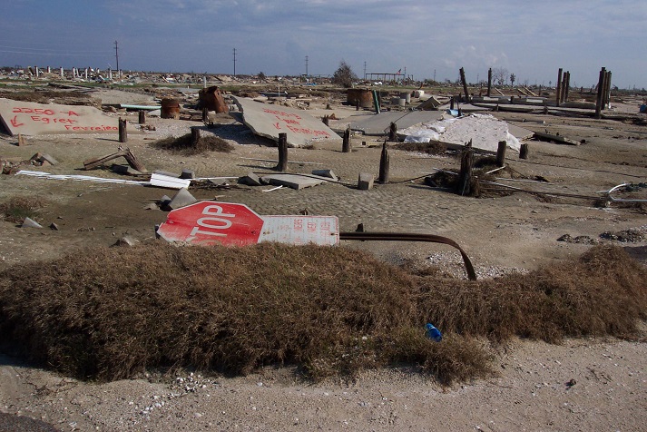
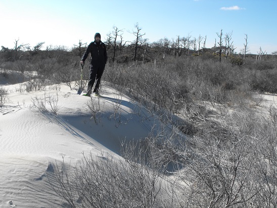
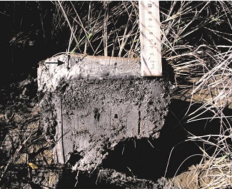
Aftermath of Hurricane Rita, Holly Beach, Louisiana. Hurricane Irene washover fan, Assateague Is. Hurricane Ike storm surge sedimentation
Current Research Projects:
1. Geologic Records of Holocene Typhoon Strikes on the Gulf of Thailand Coast. This paleotempestology project has the aim of finding geologic evidence of prehistoric typhoon strikes in coastal marshes on the Gulf of Thailand. Preliminary results indicate that typhoons were more frequent in the mid-Holocene compared to the late-Holocene. The focus for future research is the hypothesis that typhoons were more frequent and/or more intense in Southeast Asia in the mid-Holocene because of climatic changes stemming from the mid-Holocene Warm Period.
2. HurricaneStorm Surge
Sedimentation On The McFaddin National Wildlife
Refuge, Texas: Implications For Coastal Marsh
Aggradation (Joshua Hodge
, thesis research). This study
uses the storm surge sediment beds deposited by Hurricanes Audrey
(1957), Rita (2005) and Ike (2008) to investigate changes in
sedimentation on the McFaddin National Wildlife Refuge in
Southeast Texas.
Recent Research Projects:
1.GIS-based analysis of foundation repairs and soil conditions in the Dallas-Fort Worth region. This study used GIS to explore the relationship between expansive soils that are poorly-suited to urban land uses and foundation damage in the DFW region.
2.Field-based monitoring of sediment runoff from natural gas well sites in Denton County, Texas. This study quantified sediment runoff from newly-developed gas well sites; changes in sediment runoff after site re-vegetation, and determined if sediment was entering local stream channels.
3. GPS-Based Analysis Of Shoreline Change, 1995-2005, Mad Island Marsh Preserve, Matagorda County, Texas. This study assessed recent shoreline erosion on Mad Island Marsh Preserve, using field surveying, GPS, GIS and aerial photographs. The study also evaluated the ability of a newly-constructed concrete barrier to halt erosion.
4.Impact of urbanization on storm response of White Rock Creek, Dallas. This study documents hydrological changes resulting from urbanization of the upper sub-basin of White Rock Creek watershed in Collin and Dallas counties, Texas. The watershed was transformed from 87\% rural in 1961 to 95\% urban in 2002. The objective of the study was to investigate changes in the storm response of White Rock Creek in terms of peak storm flow, storm flow volume and lag time.